
Yukon. We have barely touched the Yukon Territory so far, but it has touched us. This place is great; the views have been spectacular and interesting, and the people have been SOOO friendly and welcoming!

We entered the Yukon at Watson Lake, coming out of British Columbia. You might be familiar with Watson Lake as home to the Sign Post Forest. Ah yes, you say; now I know where you mean.
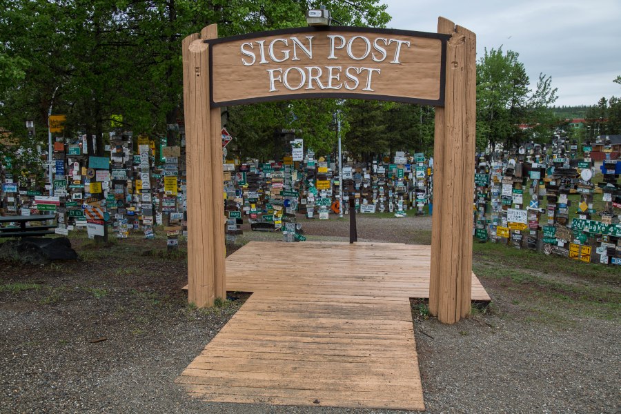
If you have made it to Watson Lake, you are approximately halfway between New York City and Tokyo.

As a camp during the construction of the Alaska Highway in 1942, mileage signposts were erected, one thing led to another, and before you know it, 75 years later, there are now about 84,000 signs.


Most of this territory (it is a territory, not a province) has a subarctic climate – meaning it gets freaking cold here. We are here in June and we can’t turn without seeing snow. Temperatures so far have been mild (50’s, 60’s during the day), with nighttime temperatures in the 30’s or 40’s. We have yet to use our AC unit on this trip.


Even northern provinces have construction, even though some of the road may not be paved. Road construction. Some things are universal.

Lets talk about size. Looking at a map, the Yukon Territory in height would be about the distance going from Seattle to San Diego, and width at its broadest to about the eastern side of New Mexico. This place is huge!

Keep in mind that this entire territory has a total population of about 35,000 people. And most of them (about 25,000) are in Whitehorse, the only city in the entire territory! The second biggest population is in Dawson City, and it has a population of about 1,500. Whitehorse and Dawson represent the only places where population is measured in thousands – all others are measured in tens or hundreds. Amazing.
The Yukon River (Yukon means white water river in the Gwith’in language) is the predominant waterway and watershed, and the namesake to the territory. The river starts in British Columbia and ends 2,000 miles later in Alaska, emptying into the Bering Sea. Rivers like the McKenzie, Liard and Artic Red River empty into the Beaufort Sea to the north.


We stopped at a rest area that offered views of a river, and while approaching a restroom we were cautioned that there was already an occupant, even though it appeared at first glance there was no one using the facilities. Well, a wayward porcupine was perched in the rafter of this restroom! Now if you hadn’t been aware before entering, you certainly would have become aware upon sitting down. Yikes. That would hurt. I took a few pictures, but from a respectful distance.


The common thing about all of this neck of the woods is the mountains, the water (creeks, rivers, lakes…), and the sense of being close with nature.


We were so close to nature that we got it all over our vehicles. Note to self: slow down on wet unpaved roads.


When we arrived in Whitehorse we camped out at the Wolf Creek campground, one of the territory parks. This place was great! For about $10 per night you would get a campsite – and free firewood! Like any place here, you need to be “bear aware”, but we saw no signs ourselves, although there were reports of recent bear activity in the campground.


While in Whitehorse, we also visited Miles Canyon, which has some fabulous views and water color – all part of the Yukon River.


One of our “places to see” on this trip was Skagway, Alaska, and since it was about 1 ½ hours away, we decided to see this town while camped at Wolf Creek. So off we go down the Klondike Highway to visit this coastal town. The views on the Klondike Highway are simply jaw dropping.


I should mention before you get too excited that cruise ships make Skagway a destination, and if you are familiar with any towns where cruise ships land, well, you know those towns are ruined. There must have been 100 jewelry shops in this town. Are you kidding me? That means there are 10 jewelry stores for each inhabitant of this town. Good information.


When crossing the border into Alaska, the border guard asked us our intentions. I said we planned on taking the day to see Skagway. He smiled and said, “Won’t take you that long!” We had lunch in a saloon that used to be a brothel, and returned to our campsite back in the Yukon. I said USED to be a brothel, in case you weren’t listening.

Whitehorse, the capitol of this territory, is the only city in the Yukon! There is a Wal-Mart, many others stores – even a Starbucks if you can believe it!

The Wal-Mart parking lot in Whitehorse would vie for largest campground in the country! There must be 40-50 RV units of all ages and sizes in this parking lot! If you want to talk about diversity, this place has it. There are motor coaches, fifth wheels, travel trailers, and home-made rigs that defy description. Literally all of them are tricked out in their own way for traveling in remote areas.


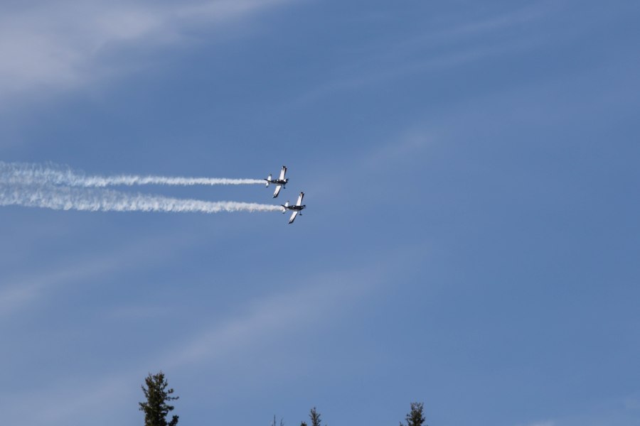
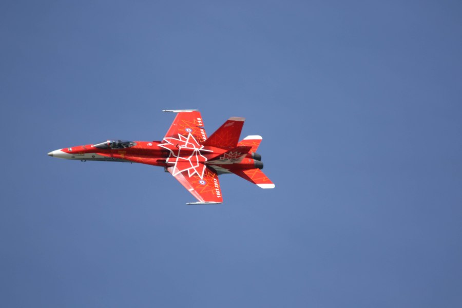
Earlier today, while using out time in the city to do a few chores, was an airshow. For a place with so few people and such long distances flight is a common method of getting from place to place. So it was kind of cool to get a little display of some flying magic!


Tomorrow we expect to continue our travels north – next destination: Dawson City, YT.
This post brings back so many memories! We have a sign somewhere in the Signpost Forest. How lucky you were to be there for the air show!